
What does Planet Labs do? At first glance, the answer seems simple: it takes pictures of Earth from space. But for investors, Planet Labs is much more than a satellite imaging company. It operates one of the world’s most active Earth observation constellations, collects high-frequency geospatial data, and turns that data into insights used by governments, defense agencies, agricultural companies, financial institutions, climate researchers, and other organizations that need to monitor change on the ground.
Daily Scanning of the Entire Planet
One of Planet Labs’ biggest competitive advantages is its ability to image Earth’s landmass every day. Unlike traditional satellite operators that focus on selected locations or less frequent captures, Planet’s constellation is designed to work more like a “line scanner” for the planet – continuously collecting visual data and making it possible to track changes almost in real time. This daily refresh gives customers a powerful tool for monitoring agriculture, forests, infrastructure, military activity, natural disasters, supply chains, and environmental changes.
- Planet Labs can provide frequent, broad-scale Earth observation rather than occasional snapshots.
- Daily imaging helps detect changes quickly, instead of waiting days or weeks for updated satellite data.
- This capability is valuable for governments, defense, climate monitoring, agriculture, insurance, and financial analysis.
- The company’s data becomes more useful over time because customers can compare current images with historical patterns.
- For investors, this daily monitoring model is central to Planet Labs’ long-term value proposition.
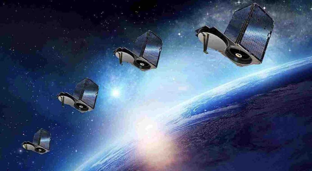
Managing a Massive Satellite Fleet
Another key thing to understand about Planet Labs is the scale of its satellite operations. The company operates one of the largest Earth-imaging satellite constellations ever built, relying mainly on small Dove satellites – roughly the size of a shoebox – as well as larger SkySat satellites for higher-resolution imaging. This approach allows Planet to combine broad, frequent global coverage with more targeted, detailed observations where customers need deeper analysis.
- Planet’s large fleet gives the company strong coverage and frequent revisit capabilities.
- Dove satellites are small, relatively low-cost, and designed for broad daily Earth observation.
- SkySat satellites support higher-resolution imagery for more detailed monitoring.
- Managing such a large constellation requires advanced satellite operations, data processing, and ground infrastructure.
- For investors, the size and efficiency of Planet’s fleet are important parts of its competitive moat.
Delivering High-Resolution Data
Planet Labs is not only about daily global coverage. Through its SkySat satellites, the company also provides very high-resolution imagery, with precision below 50 cm per pixel. This level of detail allows customers to analyze specific locations much more closely – from infrastructure and ports to roads, construction sites, industrial facilities, and vehicle-level activity.
This matters because many commercial and government use cases require more than broad monitoring. A daily image of a region can show that something has changed, but high-resolution SkySat imagery can help explain what changed and why it matters. For investors, this gives Planet Labs a more flexible product offering: wide-scale monitoring through its Dove satellites and more detailed, premium imaging through SkySat.
Analytics for Agriculture
Planet Labs’ satellite data can be especially valuable in agriculture, where frequent observation helps farmers, agribusinesses, insurers, and governments understand what is happening in the field without relying only on manual inspections. By using vegetation indices such as NDVI, Planet’s imagery can help track crop health, detect stress earlier, and identify differences between fields or even specific zones within the same farm.
In practical terms, this can support better decisions around fertilization, irrigation, pest control, and harvest planning. Instead of treating every field the same way, farmers and agricultural companies can use satellite-based insights to focus resources where they are actually needed. For investors, agriculture is an important use case because it connects Planet Labs’ data with a large global market that increasingly depends on precision farming, climate resilience, and yield forecasting.
- Crop health monitoring: identifying areas where plants show signs of drought, disease, nutrient deficiency, or pest pressure.
- Fertilization planning: helping farmers apply fertilizer more precisely instead of overusing it across the entire field.
- Irrigation optimization: detecting water stress and prioritizing fields or zones that need additional irrigation.
- Yield forecasting: estimating potential harvest volumes based on vegetation patterns and crop development.
- Insurance assessment: supporting crop insurance providers in verifying drought, flood, hail, or storm-related losses.
- Supply chain planning: helping food producers and commodity traders anticipate changes in crop availability.
- Government food security monitoring: tracking agricultural regions at scale to assess risks to national or regional food supply.
Environmental and Climate Monitoring
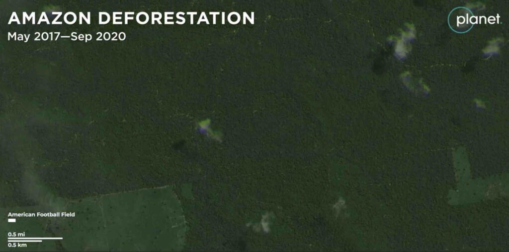
Planet Labs’ data is also used to monitor environmental change at scale. Because the company captures frequent satellite imagery, it can help governments, NGOs, researchers, and companies track how landscapes are changing over time – from forest loss and glacier retreat to water shortages and illegal extraction activities. This is particularly useful in areas that are remote, difficult to access, or politically sensitive.
In practice, satellite monitoring can turn environmental changes into measurable data. Instead of relying only on field reports, organizations can compare images over days, months, or years to detect patterns, verify incidents, and react faster. For investors, this matters because climate intelligence and environmental monitoring are becoming increasingly important for public institutions, private companies, insurers, and ESG-focused decision-makers.
- Deforestation in the Amazon: detecting illegal logging, new roads, forest clearing, and changes in protected areas.
- Glacier monitoring: tracking the retreat of glaciers and changes in snow or ice cover over time.
- Illegal mining detection: identifying new mining pits, access roads, sediment pollution, and land degradation in remote regions.
- Water level changes: monitoring lakes, reservoirs, rivers, and wetlands affected by drought, flooding, or overuse.
- Disaster response: assessing the scale of wildfires, floods, hurricanes, landslides, and other climate-related events.
- Coastal erosion: observing how shorelines change due to storms, rising sea levels, and human activity.
- Corporate ESG reporting: helping companies verify land-use impact, supply chain risks, or environmental commitments.
Support for Defense and Intelligence
Planet Labs’ satellite imagery can also support defense and intelligence operations by giving governments and security organizations a broader view of what is happening on the ground. Frequent Earth observation helps monitor changes near borders, track the visible effects of armed conflicts, assess damage to infrastructure, and identify unusual activity in strategic areas. For investors, this is an important segment because defense and government customers often need reliable, recurring access to geospatial data.
- Monitoring military movement: observing changes in vehicle concentrations, temporary camps, airfields, ports, or transport routes.
- Border security: helping detect new infrastructure, crossings, road activity, or changes in sensitive border regions.
- Conflict assessment: documenting damage to roads, bridges, energy facilities, airports, or urban areas after attacks.
- Humanitarian support: helping organizations understand population displacement, destruction of civilian infrastructure, or access constraints.
- Maritime and port monitoring: tracking activity around ports, naval facilities, shipping lanes, or strategic logistics hubs.
- Early warning and situational awareness: comparing current imagery with historical data to identify unusual developments.
- Verification of public claims: supporting independent analysis of conflict events, infrastructure damage, or territorial changes.
Crisis Response
Planet Labs’ satellite imagery can play an important role in emergency response after natural disasters such as floods, earthquakes, wildfires, hurricanes, or landslides. Because the company collects imagery frequently, its data can help emergency services, governments, insurers, and humanitarian organizations assess the scale of damage shortly after an event occurs. This is especially useful when roads are blocked, communication networks are down, or affected areas are too dangerous to inspect from the ground.
In practice, satellite images can help identify flooded zones, burned areas, damaged infrastructure, blocked transport routes, or communities that may need urgent support. For rescue teams, this can improve prioritization and resource allocation. For investors, crisis response is another example of how Planet Labs’ data can become mission-critical – not only for commercial analysis, but also for public safety, disaster recovery, and humanitarian decision-making.
A Game-Changing Data Platform
What makes Planet Labs especially interesting is that the company is not just selling satellite images. Its bigger ambition is to act like a geospatial data platform – a SaaS-like system where customers can access imagery, compare changes over time, and use AI-powered tools to extract insights automatically. Instead of manually reviewing thousands of satellite images, companies, researchers, and government agencies can use Planet’s platform to detect patterns, monitor assets, and turn raw visual data into practical decisions.
This is a potential game changer because it moves Planet Labs beyond the traditional satellite business model. The real value is not only in capturing Earth imagery, but in making that data searchable, repeatable, and useful at scale. For example, AI can help count ships in ports, track construction progress, identify new buildings, monitor deforestation, or detect changes in infrastructure. For investors, this platform approach matters because it could support recurring revenue, deeper customer integration, and higher-value analytics services over time.
- Counting ships in ports: useful for trade analysis, supply chain monitoring, and economic intelligence.
- Tracking construction activity: monitoring new buildings, roads, industrial sites, or infrastructure projects.
- Detecting land-use changes: identifying deforestation, mining expansion, urban growth, or agricultural shifts.
- Monitoring business assets: helping companies observe facilities, logistics hubs, energy sites, or transport routes.
- Automating research workflows: allowing scientists to process large volumes of imagery without manual image-by-image analysis.
- Supporting AI-based alerts: notifying users when something changes in a specific location.
- Turning imagery into recurring intelligence: making Planet Labs less of a “satellite photo provider” and more of a data and analytics platform.
Is Planet Labs a Good Stock to Buy?
So, is Planet Labs a good stock to buy? For investors looking for exposure to space, AI, defense, climate intelligence, and geospatial data, Planet Labs is certainly one of the more interesting companies to watch. Its core advantage is not only that it owns a large satellite constellation, but that it turns Earth observation into recurring data products for governments, defense agencies, corporations, researchers, and agricultural businesses. The company has also shown improving financial momentum: in fiscal 2026, Planet reported record full-year revenue of $307.7 million, up 26% year over year, while fourth-quarter revenue grew 41% to $86.8 million.
The bullish case is stronger than it used to be because Planet is no longer just a “future potential” space company. It has a large backlog, high recurring contract value, growing demand from government and defense customers, and an expanding AI/data platform angle. Still, it is not a risk-free investment. The company operates in a capital-intensive market, its valuation can be volatile, and despite adjusted profitability, investors should still watch whether revenue growth can translate into durable GAAP profitability over time. Planet ended fiscal 2026 with $900 million in backlog, up 79% year over year, and reported its first full year of positive adjusted EBITDA at $15.5 million.
- Strong growth story: record revenue and rising demand for satellite data.
- Unique market position: one of the few companies capable of frequent, large-scale Earth observation.
- Recurring revenue potential: customers often need continuous access to updated data, not one-off images.
- Defense and government demand: geopolitical tensions may increase the need for independent satellite intelligence.
- AI upside: automated image analysis could make Planet’s platform more valuable over time.
- Large backlog: a growing backlog gives better revenue visibility for the coming years.
- Climate and ESG use cases: monitoring deforestation, water levels, agriculture, and disasters creates long-term demand.
- Main risk: the stock may already price in a lot of optimism, especially after strong recent performance.
- Another risk: the company still needs to prove that it can scale profitably on a consistent GAAP basis.
- Bottom line: Planet Labs may appeal to investors with a higher risk tolerance who believe satellite data, AI analytics, and geospatial intelligence will become much more important over the next decade.